Top 10 Mountain Biking Trails in Southern Utah
Posted: May 08, 2018 | Author: Phenix Johnson | Read Time: 10 minutes
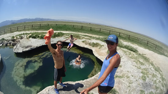
 Southern Utah is a vast playground for outdoor enthusiasts. It has countless recreation opportunities for every experience level all within a short drive from Cedar City. What some might not know is that there are fifty miles of mountain biking trails on the mountain slopes east of Cedar City, so you don’t have to go far to have fun.
To help you get to know the area better we put together a list of top-10 mountain bike trails in southern Utah. From easy to difficult, short to long, and close to further away, this list contains a large variety of trails that can help you discover the diverse landscapes surrounding Southern Utah University.
Lichen It, Cedar City
Distance from SUU: 7 minutes
Difficulty: Easy
Length: 2.8 miles
Best Season: Spring, Summer, Fall
The Trail: Lichen It is a beautiful dirt trail surrounded by Juniper trees. It’s perfect for beginners and has enough room for two-way traffic. The trail meanders back and forth across the face of the mountain as it climbs the west-facing slope. The trail is kept clear of rocks and dips and the rate of climb is consistently easy. Lichen It ends at an altitude of 6550 feet, 2.8 miles from the trailhead. Beginners should turn around and descend Lichen It back to the trailhead, but advanced-level bikers can continue straight ahead to join into the Lava Flow trail.
NOTE: Just 1/10 mile from the trailhead, Lava Flow joins on your right. Keep left on Lichen It. Lava Flow is a one-direction bikes-only flow trail. Do not enter from downhill.
Getting There: Head to S. Shurtz Canyon Dr, Cedar City. The trailhead begins there.
Lava Flow, Cedar City
Distance from SUU: 7 minutes
Difficulty: Upper-Intermediate, Advanced
Length: 4.8 miles
Best Season: Spring, Summer, Fall
The Trail: Lava Flow is a continuation of the Lichen It trail. You will know when the trail changes from Lichen It to Lava Flow because it is marked by a sign and you will run into several rock rollovers. As you gain more altitude the trail becomes more technical with rock slabs of sandstone, basalt and granite. The trail reaches an altitude of 6,550 feet, then proceeds to drop 500 feet over 1.8 miles.
Getting There: Head to S. Shurtz Canyon Dr, Cedar City. The trailhead begins at Lichen It, which is the first half of the Lava Flow loop.
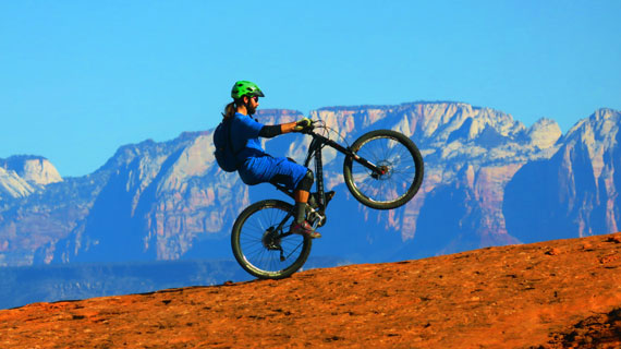
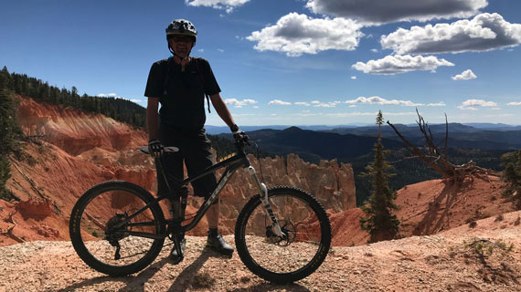
Blowhard Mountain, Brian Head
Distance from SUU: 45 minutes
Difficulty: Advanced
Length: 7-19.2 miles
Best Season: Spring, Summer, Fall
The Trail: Blowhard Mountain is an advanced, technical downhill trail. The trail drops 3,300 vertical feet. It seems easy going at the beginning but after one mile the trail begins to drop, with plenty of large roots and angular chunks of limestone. For the next mile there are fast drops and technical areas, but after that it becomes an upper-intermediate trail. You can either take a shuttle vehicle to the top and ride down the 7-mile trail or take the loop option for a 19.2-mile ride. Although the extra 12 miles are on paved or gravel roads it’s a difficult climb that takes most experienced road climbers 80-90 minutes.
Getting There: Zero your odometer at the intersection of Center and Main Street in Cedar City. Head east up the canyon on U-14. At mile 9.2 underneath cliffs there’s a pullout on the left side where the trail ends. If you’re not planning on riding the long loop leave a vehicle closeby. Continue on U-14 to reach the trailhead and turn left on U-143 at mile 18.1. Drive 2.3 miles (mile 20.3) and turn left onto a gravel road. You’ll find the trail sign after 1.1 miles (mile 21.4).
Thor’s Hideout, Thunderbird Gardens
Distance from SUU: 5 minutes
Difficulty: Upper-Intermediate
Length: 3.4 miles
Best Season: Spring, Summer, Fall
The Trail: Thor’s Hideout is perfect for more experienced bikers who want a challenge. It has plenty of rock squeeze plays, steep side-slopes and tight turns. The beginning is an easy ride on an ATV trail. At mile 0.35 turn off the ATV track onto singletrack. The trail will automatically rejoin the ATV trail at the next right but you’ll leave it again at mile 0.5. You will briefly rejoin the ATV trail at miles 0.65 and 0.9. At mile 1.5 you’ll reach a fork in the road that marks the little loop that starts you on your way back. The loop turns back at mile 1.7 where the trail reaches a ridgeline. You can either go around the loop or continue downhill to Highway 14.
If you choose to go to Highway 14 you can either ride the Red Mountain trail or go down the paved Coal Creek bike trail. To get to Red Hollow, ride down Highway 14 to the Red Mountain Trailhead. Thor’s Hideout may be a short trail, but it collides and intermixes with many other trails that you can mix and match to have a different experience every time.
Getting There: Head to Thunderbird Gardens Trailhead east of Cedar City. Parking is free and the trail is clearly marked.
Brian Head Bike Park, Brian Head
Distance from SUU: 41 minutes
Difficulty: Easy to Advanced
Length: 3-4 miles
Best Season: Spring, Summer, Fall
The Trail: To get to the top of the trails you can either purchase a lift pass or shuttle yourself to the Brian Head Peak Trail and take different routes through the park. It’s a great place for mixed-ability bikers to spend time on the same mountain with varying levels of difficult.
Getting There: Turn off I-15 in Parowan and head up the canyon to Brian Head. You will pass a ski lift on your right and left before reaching the Giant Steps lodge. The bike shop is on the third floor.
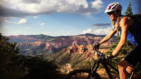
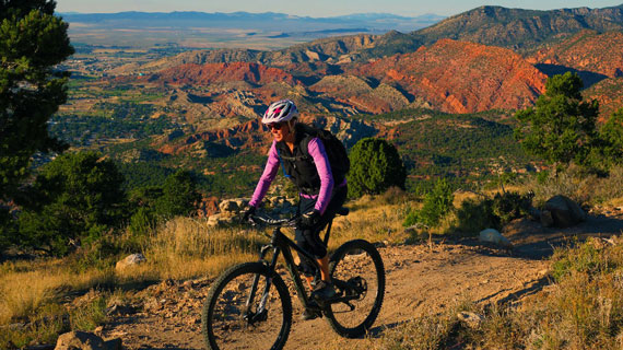
Bunker Creek Trail, Brian Head
Distance from SUU: 41 minutes
Difficulty: Beginner-Intermediate
Length: 12 miles
Best Season: Spring, Summer, Fall
The Trail: The bike shop in Brian Head provides a shuttle service for this trail. The trail starts at the Peak (11,300 feet) and ends at Panguitch Lake (3,000 feet below). It is technically easy but there are a few sections with fast drops. The trail is steep and straight, allowing riders to cruise through beautiful scenery as fast as they would like. The scenery changes from the ski hills to meadows and spruce forests. There are several forks in the trail that allow you to choose varying levels of difficulty. At the first fork (mile 1.5) you can turn left for the Dark Hollows trail or right for Lower Ponds. At the second fork (mile 4.4) you can head left for the more technical Bunker Creek route or right for a cruise.
Getting There: Turn off I-15 in Parowan and head up the canyon to Brian Head. You will pass a ski lift on your right and left before reaching the Giant Steps lodge. The bike shop is on the third floor.
Coal Creek Trail, Cedar City
Distance from SUU: 5 minutes
Difficulty: Beginner
Length: 3.4 miles
Best Season: Spring, Summer, Fall, Winter
The Trail: This paved trail is the perfect start for beginning mountain bikers and families. It follows a small creek in the canyon and never crosses the street. Instead, it slopes down to underpasses along the creek, which are easy for children. There are several other paved trails that connect to Coal Creek and it passes two community parks.
Getting There: Starting on Cedar City Main Street turn east on Center Street. It will become Highway 14. In 0.4 miles the road will cross Coal Creek. After passing the road’s bridge turn right into the parking area at Canyon Park. Ride toward the bridge to find the trail.
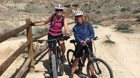
Casto Canyon Trail, Near Bryce Canyon
Distance from SUU: 74 minutes
Difficulty: Beginner-Intermediate
Length: 7.4-14.4 miles
Best Season: Spring, Summer, Fall
The Trail: This trail is surrounded by orange rock and beautiful cedar and pine trees. It is a fairly easy trail for beginners if they turn back at mile 3.7 for a total trip of 7.4 miles. This turn back spot will be marked by a singletrack that forks off the ATV trail. For a longer, and more technical trip, riders can take the singletrack and loop back when it rejoins the ATV trail at mile 5.7. When you rejoin the ATV trail turn left and head uphill to loop back. The trail crosses a creek 20 times so, depending on the time of year, plan for wet tires and a wet bike chain. It would be smart to bring a small towel to clean the chain part way through.
Getting There: From US-89 drive 2.9 miles east on U-12. Turn left on the gravel Casto Canyon Road. Drive three miles and you’ll reach a parking area on your left.
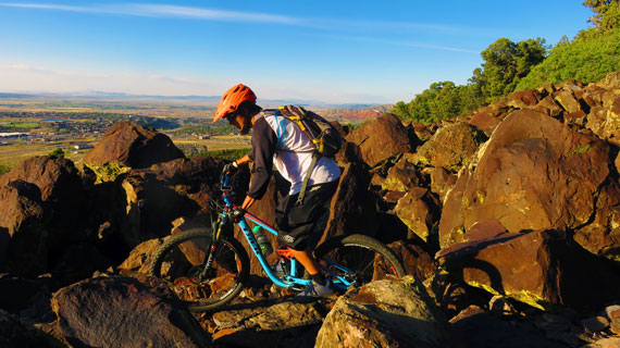
Bearclaw Poppy, Saint George
Distance from SUU: 55 minutes
Difficulty: Beginner-Intermediate
Length: 10.8 miles
Best Season: Spring, Summer, Fall, Winter
The Trail: This is the most popular trail in Saint George and can be ridden year round, though you should avoid it after a rainstorm to help preserve the trail. This trail makes a figure eight pattern that crosses over at the base of the Acid Drops. There are lots of side trails but you’ll reach your destination no matter where you go. For the easiest trip take the main trail. Make sure to look ahead and bike carefully, especially if you’re a beginner, because there are some steep hills and bumps ahead. Cross the fence and take the Bloomington Microloop Trail on your left and follow it for two miles to the base of the Acid Drops (very steep, white hills). Cross over the Bearclaw Poppy Trail but don’t follow it through the pass over to Green Valley. Continue to Stucki Springs (mile 5.0) and turn left over a dry wash. Take another left around mile 6 to the Snake Pit section. This area is known as “the rollercoaster” because it’s fast and smooth. As the wash opens up take a left to go back to the base of the Acid Drops and head down the Bearclaw Poppy trail.
Getting There: Head to Saint George on I-15 and take exit 5 toward Dixie Dr. Keep right onto W Dixie Drive then turn left onto S 600 W. At the first roundabout take the first exit onto Tonaquint Drive. Take a slight right turn onto W Bloomington Drive then turn right onto Navajo Drive. Go to the west end of Navajo Drive. Go across the cattle guard. See the low rail on the fence 100 feet to your right? That's the trailhead.
JEM Trail, Hurricane
Distance from SUU: 44 minutes
Difficulty: Beginner
Length: 12.9 miles
Best Season: Spring, Summer, Fall
The Trail: From the lower trailhead off Highway 9 backtrack 0.2 miles and turn right on the gravel road. At mile 2.1 you’ll drop through a big wash, then turn left off the main road at mile 2.3. The trail will cross the main road many times. You’ll see an old corral and gate just up the road which marks a more difficult area so it’s easier to stay on the main road. At mile 4.4 the road forks. Go right. At mile 6.7 take the singletrack on your right. This is the best part because it’s fast and fun. At mile 7.1 there are a few technical switchbacks. The trail crosses the main road at mile 8.4 and at mile 11.4 the Hurricane Rim trail forks off to the left. Keep right to finish the loop. At mile 11.5 the trail drops and follows the Virgin River taking you back to the parking area.
Getting There: Take the UT-9 exit from I-15 about 15 miles north of St. George. Turn towards Hurricane toward Zion National Park. At the junction of US-9 with UT-17, turn east towards Zion. 4.8 miles after the turnoff, turn right on a gravel road signed "Sheep Bridge Rd." 0.5 miles later, you'll cross over the Virgin River. Just uphill is a cattle guard, then a doubletrack on your right 0.1 miles after the bridge. Take the doubletrack 0.2 miles to a turn-around overlooking the Virgin River. The singletrack is at the end of the turn-around. For the classic (old) JEM loop ride, head back on the dirt road.
If you don’t know how to mountain bike and or would like to learn more stop by SUU Outdoors for tips. You can also head to SUU alumni-run outdoor shop, Cedar Sports, or Cedar Cycle to rent a mountain bike. Check with their calendars to see when they have mountain biking seminars planned. You can also head to Bike Route if you’re ready to commit to a purchase.
This article was published more than 3 years ago and might contain outdated information or broken links. As a result, its accuracy cannot be guaranteed.