Geosciences Start New Degree in Geospatial Sciences
Published: April 07, 2022 | Author: Kaylee Condie | Read Time: 3 minutes
 We live in a world full of acronyms, and sometimes we don’t realize that they’re there. ASAP, PIN, GPS, SCUBA, and GIS, are just a few of them. ASAP stands for As Soon As Possible, PIN is for Personal Identification Number, GPS, the voice in our phones and our cars are for Global Positioning System, SCUBA, other than being a really fun word to say, stands for Self-Contained Underwater Breathing Apparatus, and GIS, or Geographic Information Systems, which is one of many technologies used in the new Geospatial Sciences degree at Southern Utah University, starting fall 2022.
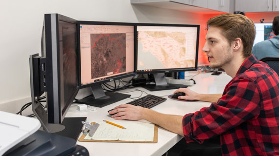
Geospatial Science is the combination of the theories of Geography and the application of geospatial technologies including; GIS (Geographic Information Systems), RS (Remote Sensing - satellite surveying), GPS – (Global Positioning Systems), UAVs (Unmanned Aerial Vehicles - drones), and Photogrammetry (using aerial imagery to measure objects on the ground).
“Geospatial science, through the integration and use of geospatial technologies, allows
professionals to make better informed decisions over a broad range of disciplines,” said David
Maxwell, GIS program director.
Geospatial technologies are the technology that tracks anything anywhere in a spatial
capacity. When you use a Garmin watch to track where you run - that’s using GPS and a form of
GIS for storing and retrieving that data. When someone launches the Google Maps app on their
phone to meet their friends, or when shopping deliveries make their way from the storage units
and stores to the front door, that’s all geographic information systems working together to help
solve problems. Every delivery system uses some integration of GIS and specialized
geospatial equipment. One such example of geospatial equipment here at SUU is the arsenal
of drones the geoscience department is building up in order to better understand the constantly
changing surface of the earth and the improvement of these tracking systems.
With the new degree in Geospatial Science at SUU, as well as many other degrees that heavily
involve GIS, what makes the new degree stand out lies within its ability to introduce the student
to the use of all the geospatial technologies and how to build these systems to make spatially
informed decisions.
When the GIS certificate was first introduced to the University, it required additional credits on
top of a bachelor’s degree, sometimes requiring three additional semesters. The new Geospatial
Science degree at SUU helps organize course work to be completed with no additional
semesters, while fully integrating the existing GIS certificate into the program. By incorporating
geographic theory with the practical geospatial technology hands-on skills, the student is able to
complete the GIS Certificate and apply it towards the new Geospatial Science degree.
Many new students of varying interests in any field would be interested to know that GIS can
give them a leg up in their studies. With the inherent interdisciplinary nature of geospatial
technology, its use has grown across campus and has worked its way into curriculum and
research areas such as Geoscience, Biology, Physical Science, Engineering, History, Sociology
and Anthropology, Criminal Justice, Outdoor Recreation and others.
“What can GIS not be used for? Everything is tracked, and everything has a spatial component, ” says Maxwell.
We all live in one spatial component or another - where we live, how far we generally travel, and where we’re trying to get to. Almost all of us have an inherent understanding of basic Geographic Information Systems, nearly all of the apps on a smartphone pertain to it in some form or another. It could be a good idea to learn more about it - right here in the GIS Department at SUU.
Tags: Student Geosciences
Contact Information
435-586-5400
Contact the Office of Marketing Communication
This article was published more than 3 years ago and might contain outdated information or broken links. As a result, its accuracy cannot be guaranteed.