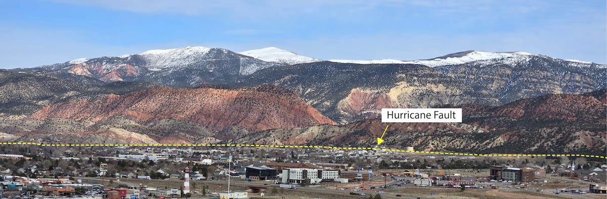
Hurricane Fault - Coal Creek Trail
Have you ever felt an earthquake? Earthquakes typically caused by the sudden release of energy from motion along a fault. Faults are defined as fractures in the Earth’s crust that have displacement or offset. At this stop, you are standing at the approximate location of the largest active fault in Southern Utah. Can you find any evidence of a large fault?
How do faults form?
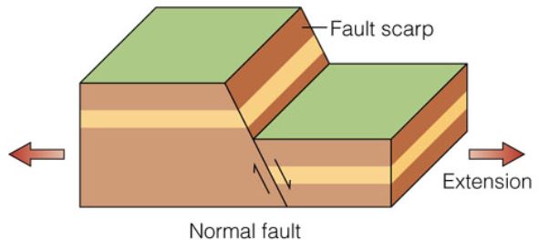
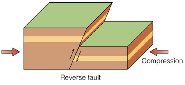
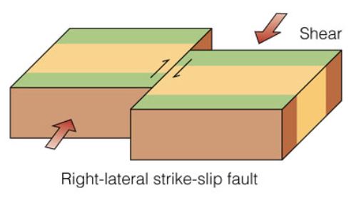
Faults are caused by outside forces acting on the rock. Most faults on Earth are the result of tectonic plates moving slowly to pull or push on different parts of the crust. As this happens the crust will break into separate blocks of rock that then shift in opposite directions along a fault. Depending on the direction of forces (pulling or pushing) different types of faults can form.
There are 3 basic types of faults.
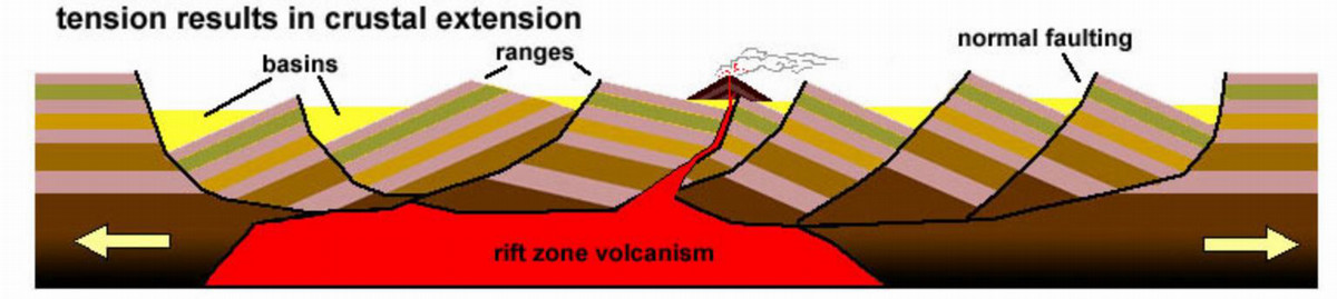
The Basin and Range
For the past 20 million years a portion of western North America, including western Utah, have been slowly stretching apart. This has caused many normal faults to form. These faults cause one side to drop down to form basins and the other side to uplift to form mountain ranges. Our region is dominated by these features, giving us the geographical region known as the basin and range. Cedar City is located on the eastern edge of this region, which is marked by the large-scale offset of the Hurricane Fault (see image at the top).
The fault is easily recognized by the flat and relatively low Cedar Valley on the west and the elevated Markagunt Plateau on the east. The eastern edge of Cedar Valley is marked by a rapid rise in topography. The fault is at the base of this rise. The Hurricane Fault extends about 250 km (~155 miles) from northern Arizona to just north of Cedar City.
Uplift and Erosion
Cedar Canyon is a beautiful feature that hosts the Coal Creek paved trail. This canyon exhibits wonderful views and a variety of interesting rock features. The canyon itself was carved by Coal Creek. Rapidly flowing water, especially during flood events has slowly cut down into solid rock to produce the canyon. However, the canyon itself is also directly connected to the Hurricane Fault. As the Markagunt Plateau rises and Cedar Valley drops (relatively), the slope of Coal Creek steepens. This gives the creek more power to remove rock material as it flows. Without the Hurricane Fault causing uplift the creek would not be steep or fast enough to produce such a magnificent canyon. In fact, the Hurricane Fault is responsible for many canyons such as Kannarra Canyon or even Zion Canyon for the same reason.
Earthquakes
The Hurricane Fault is an active fault. It produces frequent earthquakes. The vast majority of these are very small, but based on the length and overall offset along the fault it is capable of large, energetic earthquakes. Even as large as a magnitude 7. Earthquakes happen when there is a sudden shift on a fault. As this happens energy is released in the form of seismic waves which can move Earth’s surface up and down or side to side. Since Cedar City is in earthquake country, it is very important to be prepared for large earthquakes.
Educator Resources
Educators can download resources for teaching on the Coal Creek Trail.